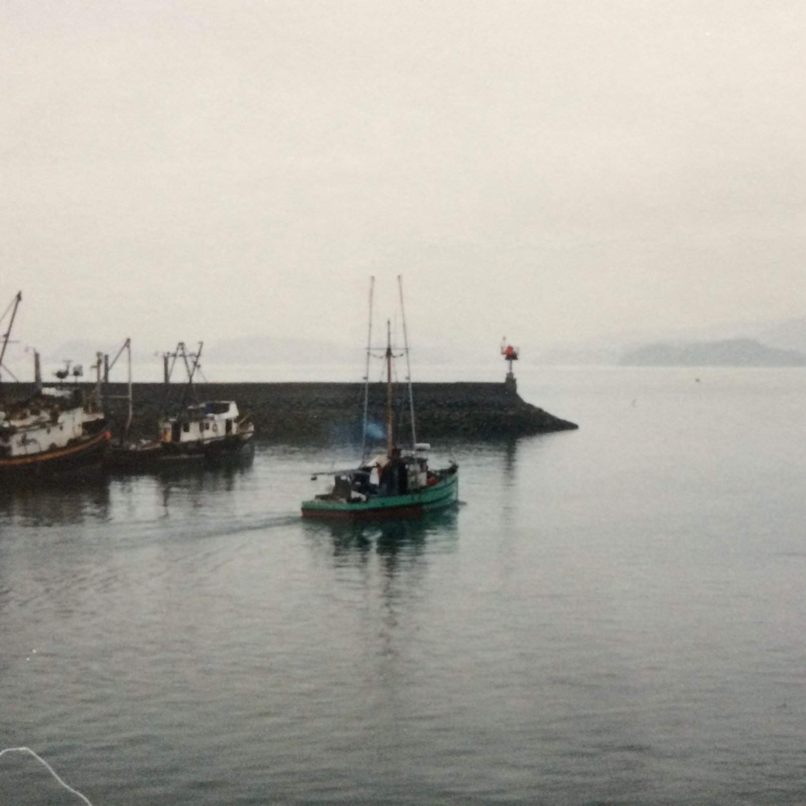
Dividing Line: The Etolin Harbor Breakwater

It just sits there. It doesn’t seem to be doing anything. And yet, it protects the beating heart of Wrangell.
This is the story of the Etolin Harbor Breakwater.
A Place to Call Home
Plan Gavani Etolin (source: Alaska’s Digital Archives)
While the Stikine River gave Wrangell life, Etolin Harbor gave Wrangell a home.
Etolin Harbor sits near the northwest corner of Wrangell Island, formed by a peninsula stretching out line an arm, protecting the water inside from southeast Alaska’s constant, pounding waves.
In the 1830s, the Tlingit village of Kaats’litaan moved north from the southwest side of Wrangell Island to Etolin Harbor. According to the oral history of Tlingit elder Sheesh-gow, the harbor was settled by clans taking turns selecting land:
“Shaksh move first. He build house in center, on peninsula made island by high tide. To Tahl-quedy, he say, ‘My fellow townsmen, take whatever place you wish’. They choose point on right of entrance now called Shus-tak Point. Tee-hit-ton choose place next to them, center of peninsula (hha-goon). Koch’uddy take land around small creek they name Koch’. Next come Xok-ady, then Kuh-yashki-diton, then Kik’s-uddy. Soon all good land gone. That why Kahz-Xa-quedy build on what now mill site. Dukhla-wedy take place where powerhouse now. When Noo-shi [Russians] come back, Captain ask let him build fort ashore. Shaksh give part of his land, a place on inner point across from his house called Shark-house.”
According to Dr. James Crippen, the village adopted the name Ḵaachx̱ana.áakʼw in recognition of a Tlingit slaved named Ḵaachx̱ánk’ who lived alone inside the harbor before settlement. The name Ḵaachx̱ana.áakʼw was also a play on words, roughly translating to ‘convenient lake’ — a recognition of its useful proximity to the mouth of the Stikine River.
In 1868, Eadweard Muybridge photographed this group of Tlingit men and women sitting on the rocks near the tip of Shustack’s Point, with Ḵaachx̱ana.áakʼw visible in the background to the south.
Having built their post inside Etolin Harbor, the Russians were effectively encircled by the Tlingit. While this made trade convenient, the close proximity led to occasional conflicts. When the U.S. Army arrived in 1868 to construct a new fort, the Army built along the coast to the north, outside of the harbor. This was the beginning of Fort Wrangel, and it would expand.
The Cradle Rocks
Wrangell grew in the cradle of Etolin Harbor. The busy waterfront built on planks and pilings was the physical symbol of the town’s growth. Settlers, businesses, and the Tlingit had one thing in common: life was lived on the water’s edge.
By the 1910s, Wrangell’s fleet of small boats could tie up to a few pilings, but many vessels simply sat at anchor. This became dangerous when storms brought waves crashing into Etolin Harbor, smashing boats together. Some vessels found temporary shelter in Labouchere Bay, but most vessels simply left Wrangell at the end of the summer. If Wrangell could find a way to shelter Etolin Harbor, then the boats could stay year-round and the town population could grow.
Samuel Cunningham saw the potential. He’d been a fisherman and worked at the mill, but by 1919, he found a new career as a movie theater owner, and he needed people in his seats. In April 1919, Samuel Cunningham circulated a petition:
“As many as one thousand small fishing craft are in the habit of using this harbor during the winter season for lying by, but when high northerly or westerly winds blow the water becomes so rough that they are compelled to put to sea to their great peril and inconvenience. This can be obviated by the construction of a breakwater only 350 feet in length.”
Cunningham sent his petition to Alaska’s delegate in Congress, thus beginning a political and bureaucratic process that would take years.
Gears of Government
A hand-drawn figure in pen indicates the proposed location for the Etolin Harbor Breakwater. Photo circa 1922. (image source: Wikipedia)
To get the breakwater built, Wrangell had to convince Alaska’s delegate to Congress, the Army Corps of Engineers, the War Department, Congress, and the President of the United States.
But the first hurdle came when Samuel Cunningham’s petition went missing on the way to Washington. A second petition with 139 signatures went to Alaska’s delegate, George B. Grigsby, who reported Congress would not authorize any harbor projects that year, but he secured a survey of the proposed breakwater site by the U.S. Army Corps of Engineers. In 1921, the Corps reported:
“About 20,000 tons of rock will be required and while the slate rock near at hand is unsuitable for the work, good granite can be secured at Point Highfield…. The project itself is a simple engineering feat and the cost will run from fifty to sixty thousand.”
But the board overseeing the Army Corps of Engineers said no:
“While small boats have been inconvenienced by wave action and swells the actual damage and monetary loss have been small. The breakwater proposed, would afford but partial shelter and the cost of an adequate improvement would be entirely out of proportion to the interests and the probable resulting benefits.”
From 1921 to 1931, Dan Sutherland served as Alaska’s delegate to Congress. While he could not vote in Congress, he could influence members and committees on behalf of Alaskan issues.
Wrangell leaned on Alaska’s new delegate in Congress, Dan Sutherland, to get the breakwater included in Congress’s budget.
On January 26, 1922, the Wrangell Sentinel reported the Army Corps of Engineers changed its mind and officially recommended Congress build Wrangell’s breakwater. They estimated the breakwater would cost $50,000 – close to one million dollars today. Later that year, Senator Wesley L. Jones of Washington inserted the Wrangell breakwater into Congress’s harbors bill. By the end of the year, the full harbors bill budget was $71.5 million – over one billion dollars today. Congress and the President approved the budget in the spring of 1923.
Four years after Samuel Cunningham first circulated his petition, Wrangell got its breakwater.
Preparations


With the money approved, the head of the U.S. Engineers Office in Juneau, Colonel James G. Steese, opened bids. The project would require 15,000 tons of rock to build a 300-foot breakwater. The winning bid went to Nicholas Fleiness of Seattle, Washington coming in at $34,000. In the fall of 1923, with snow on the ground, inspectors came to Wrangell to document the site of the future breakwater (see photo carousel above).
In order to build the breakwater, workers needed access to the end of the peninsula to transfer people, supplies, and heavy rock, but the city townsite did not include the peninsula. That land was still largely an Indian Possession, one of the last pieces of Ḵaachx̱ana.áakʼw not absorbed by the expanding footprint of the city of Wrangell. On February 9, 1922, the Wrangell Sentinel announced a hearing on a petition to absorb the land, which was ultimately approved that May 1922:
This map is from a 1914 survey of Wrangell shows “Indian Possessions” marked in red.
“That the territory sought by said petition to be annexed to said town is described and bounded as follows… Begining at corner 35 or the northwest corner of Wrangell townsite, thence along the meander shorelien of the original Townsite Survey, to Shustak Point...”
Construction


The breakwater was a loose-stone project (see photos above). In this type of construction, smaller stones are dropped in the water first, and the largest, heaviest stones are placed on top to secure the smaller stones in place. To move heavy rock and supplies to the end of Shustack’s Point, the contractors constructed a rail line.
As to the angle of the breakwater, nature provided a clear path. About 300 feet off the tip of Shustack’s Point, a small atoll peeked its head out of the water at low tide. This atoll appears on some of the earliest maps of the harbor. The contractors used this atoll as their north star, guiding the direction of the breakwater until completely covering the atoll with rock forever.
A concrete parapet along the top of the breakwater added height and strength to the construction.
Grave Concerns

A postcard from the early 20th century labeled “Indian Graves, Wrangell, Alaska.” It’s not clear that these graves were included in Kassunk’s case, but they are examples of types of graves found around Etolin Harbor.
In June 1924, just months into the beginning of construction, Tlingit civil-rights attorney William Paul sued the contractor, Nicholas Fleiness, on behalf of his client John Kassunk, a Tlingit man living in Wrangell. The June 12, 1924 Wrangell Sentinel wrote:

William Paul
“The complaint charges Fleiness with carrying away rock, soil and trees and destroying graves. The complaint asks for damages in the sum of $12,000. Mr. Fleiness says that the charge that he was destroying graves was absolutely false, and that in carrying away rock and soil he believed he was within his rights according to the terms of his contract with the government.”
William Paul was fresh off a court victory securing Indian voting rights, and this was another front in the battle. The peninsula also held personal meaning to William Paul, as it is home to his ancestral clan, the Tee-Hit-Ton.
In July 1924, the government announced it would defend itself in court, setting up a showdown in Ketchikan. But when William Paul traveled to Ketchikan in August 1924, it wasn’t for the trial. His 15 year-old sister, Gladys Tamaree, had been seriously ill for months. Gladys and her family traveled to William Paul’s home in Ketchikan, where she passed away on August 23, 1924. There’s no public notice I could find of what became of John Kassunk’s case. It may have been a consequence of Gladys’ untimely death.
John Kassunk lived in Wrangell until he died of drowning in 1935.
A Path Forward
Wrangell, Alaska circa 1934.
In 1926, contractors completed construction of the breakwater. It changed life in Wrangell forever. In a report to the US Senate, Alaska’s Governor George Parks praised the new breakwater:
“About one year ago a long breakwater was constructed by the War Department, and this furnishes an excellent harbor for small fishing craft. As a result of this development there are a very great number of fishermen who make their homes in Wrangell. The population of the town has increased during the past few years, and I am sure that it will continue to increase more rapidly in the near future.”
The breakwater was intended to secure the harbor, but it had the effect of opening up the peninsula.
The city turned the rail route into a road. The government invested in the Municipal Float just inside the breakwater for up to 300 small vessels. Today, this is Wrangell’s Fish & Game Float. By constructing a road out to the Municipal Float, people and goods could be delivered without having to cross the harbor on a skiff. Electricity and a telephone at the float soon followed. People established homes and businesses along the road.
The breakwater marked the end of one era, and the beginning of another.
Legacy

Samuel Cunningham lived out the rest of his years in Wrangell, passing away in 1952. His obituary described him as “a boat enthusiast, Mr. Cunningham owned several pleasure boats over the years and got great enjoyment out of traversing the waterways of this region.” His petition in 1919 was the first splash of many in the creation of the Etolin Harbor Breakwater.
It’s easy to overlook what the breakwater does. It doesn’t make waves — it takes them. For nearly a century, the breakwater has taken everything the sea can throw at it and has required only occasional maintenance.
But it’s more than just a barrier. The breakwater bids seafarers farewell on the way out and welcomes them back at the end of the journey. It serves as a beacon in the dark and as a symbol of Wrangell’s maritime history. It protects Etolin Harbor, making it a safe home all year long.